
Tabor Hill地形图
点击地图以显示海拔。
关于这张地图
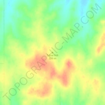
名称:Tabor Hill地形图、海拔、地势。
地点:Tabor Hill, Wabaunsee County, Kansas, United States (39.11217 -96.07893 39.11227 -96.07883)
平均海拔:325 米
最低海拔:299 米
最高海拔:348 米
其他地形图
点击地图以查看其地形、其海拔和其地势。
Maple Hill
United States > Kansas > Wabaunsee County
Maple Hill was founded about 1882. It was named from a grove of maple trees growing upon an elevation.
平均海拔:298 米
Maple Hill
United States > Kansas > Wabaunsee County
Maple Hill was founded about 1882. It was named from a grove of maple trees growing upon an elevation.
平均海拔:298 米