
Vanhook地形图
点击地图以显示海拔。
关于这张地图
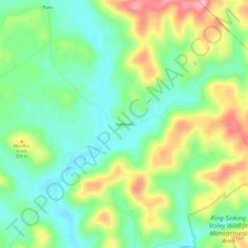
名称:Vanhook地形图、海拔、地势。
地点:Vanhook, Pulaski County, Kentucky, United States (37.19397 -84.42216 37.23397 -84.38216)
平均海拔:318 米
最低海拔:267 米
最高海拔:402 米
其他地形图
点击地图以查看其地形、其海拔和其地势。
Somerset
United States > Kentucky > Pulaski County
Somerset is located at 37°4′59″N 84°36′34″W / 37.08306°N 84.60944°W / 37.08306; -84.60944 (37.082966, −84.609387), and the downtown (central) part of the city is at an elevation of 974 feet above sea level. The city is located at the eastern end of Kentucky's Mississippian Plateau (or…
平均海拔:295 米