
Little Girl's Point地形图
点击地图以显示海拔。
关于这张地图
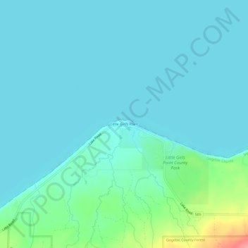
名称:Little Girl's Point地形图、海拔、地势。
平均海拔:190 米
最低海拔:176 米
最高海拔:265 米
其他地形图
点击地图以查看其地形、其海拔和其地势。
Ironwood
United States > Michigan > Gogebic County
In the early 1960s, the U.S. Air Force established a Strategic Air Command (SAC) Radar Bomb Scoring site atop Norrie hill to track and score high altitude and treetop level simulated bomb runs by B-52s and B-47s on targets in the Ironwood area. A monument is erected south of Hurley, Wisconsin to remember those…
平均海拔:458 米