
Grand Valley地形图
点击地图以显示海拔。
关于这张地图
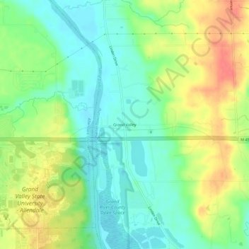
名称:Grand Valley地形图、海拔、地势。
平均海拔:199 米
最低海拔:175 米
最高海拔:234 米
其他地形图
点击地图以查看其地形、其海拔和其地势。
Zeeland
United States > Michigan > Ottawa County
According to the United States Census Bureau, the city has a total area of 3.01 square miles (7.80 km2), of which 2.99 square miles (7.74 km2) is land and 0.02 square miles (0.05 km2) is water. The town itself is located on a hill, giving the city a higher elevation compared to the surrounding township land.…
平均海拔:192 米