
Naraingarh地形图
点击地图以显示海拔。
Naraingarh
Naraingarh is located near the foothills of the Sivalik range of the Himalayas in northwest India. It covers an area of approximately 481 km2. It shares its borders with the states of Himachal Pradesh. The exact cartographic co-ordinates of Narayangarh are 30°28′N 77°08′E / 30.47°N 77.13°E / 30.47; 77.13.It has an average elevation of 325 metres (1065 ft).
关于这张地图
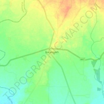
名称:Naraingarh地形图、海拔、地势。
地点:Naraingarh, Ambala, Haryana, 134203, India (30.43239 77.08427 30.51239 77.16427)
平均海拔:321 米
最低海拔:305 米
最高海拔:342 米