Northstar地形图
点击地图以显示海拔。
关于这张地图
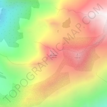
名称:Northstar地形图、海拔、地势。
地点:Northstar, Anchorage, Alaska, United States (60.99996 -148.97801 61.00006 -148.97791)
平均海拔:996 米
最低海拔:325 米
最高海拔:1,586 米
其他地形图
点击地图以查看其地形、其海拔和其地势。

点击地图以显示海拔。
名称:Northstar地形图、海拔、地势。
地点:Northstar, Anchorage, Alaska, United States (60.99996 -148.97801 61.00006 -148.97791)
平均海拔:996 米
最低海拔:325 米
最高海拔:1,586 米
点击地图以查看其地形、其海拔和其地势。