
Throsk地形图
点击地图以显示海拔。
关于这张地图
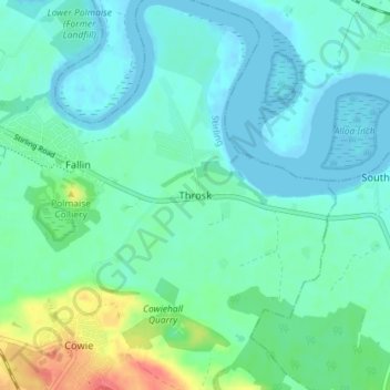
名称:Throsk地形图、海拔、地势。
地点:Throsk, Stirling, Scotland, FK7 7NA, United Kingdom (56.07918 -3.86601 56.11918 -3.82601)
平均海拔:12 米
最低海拔:-2 米
最高海拔:52 米
其他地形图
点击地图以查看其地形、其海拔和其地势。
Loch Lomond and The Trossachs National Park
United Kingdom > Scotland > Stirling
The park straddles the Highland Boundary Fault, which divides it into two distinct regions - lowland and highland - that differ in underlying geology, soil types and topography. The change in rock type can most clearly be seen at Loch Lomond itself, as the fault runs across the islands of Inchmurrin, Creinch,…
平均海拔:291 米