
Gharaunda地形图
点击地图以显示海拔。
Gharaunda
Gharaunda is located at 29°32′N 76°58′E / 29.54°N 76.97°E / 29.54; 76.97. It has an average elevation of 213 metres (698 feet). The municipal area of the town is 4.37 km² which does not include the existing and proposed area to be developed by Haryana Urban Development Authority under any town and country planning scheme.
关于这张地图
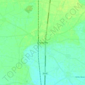
名称:Gharaunda地形图、海拔、地势。
地点:Gharaunda, Karnal, Haryana, 132114, India (29.49619 76.92979 29.57619 77.00979)
平均海拔:242 米
最低海拔:236 米
最高海拔:247 米