点击地图以显示海拔。
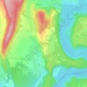
名称:Saint-Christophe地形图、海拔、地势。
地点:Saint-Christophe, La Tour-du-Meix, Lons-le-Saunier, Jura, Bourgogne-Franche-Comté, France métropolitaine, 39270, France (46.51455 5.64448 46.55455 5.68448)
平均海拔:517 米
最低海拔:423 米
最高海拔:690 米