
Mlowo地形图
点击地图以显示海拔。
关于这张地图
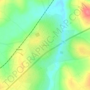
名称:Mlowo地形图、海拔、地势。
地点:Mlowo, Mbozi, Songwe Region, Southern Highlands Zone, Tanzania (-9.03402 32.98206 -8.99402 33.02206)
平均海拔:1,577 米
最低海拔:1,542 米
最高海拔:1,629 米
其他地形图
点击地图以查看其地形、其海拔和其地势。
Lake Rukwa
The alkaline Lake Rukwa lies midway between Lake Tanganyika and Lake Malawi at an elevation of about 800 metres (2,600 ft), in a parallel branch of the rift system. Almost half of the lake lies in Uwanda Game Reserve.
平均海拔:1,189 米