
Port Jefferson地形图
点击地图以显示海拔。
Port Jefferson
It wasn't until 1836 that the local leadership truly initiated the community's transition from a swampish hamlet to a bustling port town. Twenty-two acres of the harborfront, which flooded with the tides, were brought to a stable elevation with the construction of a causeway. Concurrently, the village was rechristened from "Drowned Meadow" to "Port Jefferson" The name choice was in honor of Thomas Jefferson.
关于这张地图
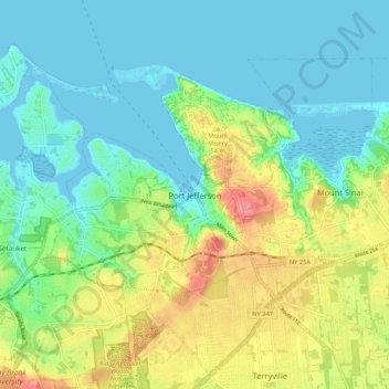
名称:Port Jefferson地形图、海拔、地势。
平均海拔:26 米
最低海拔:-4 米
最高海拔:82 米