
Mount Muller地形图
点击地图以显示海拔。
关于这张地图
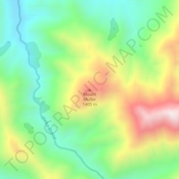
名称:Mount Muller地形图、海拔、地势。
平均海拔:1,108 米
最低海拔:816 米
最高海拔:1,573 米
其他地形图
点击地图以查看其地形、其海拔和其地势。
Saint Arnaud Range
New Zealand > Marlborough > Marlborough District
The lower elevations are covered primarily in beech forests, while higher elevations (above about 5,000 feet) are alpine.
平均海拔:1,249 米
Saint Arnaud Range
New Zealand > Marlborough > Marlborough District
The lower elevations are covered primarily in beech forests, while higher elevations (above about 5,000 feet) are alpine.
平均海拔:1,249 米