
Allans Flat地形图
点击地图以显示海拔。
关于这张地图
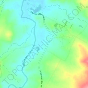
名称:Allans Flat地形图、海拔、地势。
地点:Allans Flat, Shire of Indigo, Victoria, 3691, Australia (-36.29526 146.90253 -36.27526 146.92253)
平均海拔:223 米
最低海拔:196 米
最高海拔:290 米
其他地形图
点击地图以查看其地形、其海拔和其地势。
City of Melbourne
Melbourne's topography is characterized by a diverse landscape that transitions from flat coastal plains to rolling hills and mountainous regions. The city is situated at the northern end of Port Phillip Bay, where the terrain is predominantly flat, facilitating urban development. As one moves eastward, the…
平均海拔:18 米
Melbourne
Melbourne is also prone to isolated convective showers forming when a cold pool crosses the state, especially if there is considerable daytime heating. These showers are often heavy and can include hail, squalls, and significant drops in temperature, but they often pass through very quickly with a rapid…
平均海拔:185 米
Dandenong Ranges National Park - Ferntree Gully
Australia > Victoria > Montrose
The topography consists of a series of ridges dissected by deeply cut streams. Sheltered gullies in the south of the range are home to temperate rain forest, fern gullies and Mountain Ash forest Eucalyptus regnans, whereas the drier ridges and exposed northern slopes are covered by dry sclerophyll forest of…
平均海拔:345 米
Collingwood
Collingwood's topography is mostly flat, but a prominent slope extends from Hoddle Street up to Smith Street, and also along sections of Hoddle Street.
平均海拔:30 米
Templestowe
Australia > Victoria > Melbourne
Gentle, rolling hills extend from east of the Yarra River flood plains, along Templestowe Road (towards the Eastern Freeway) for seven km (4.3 miles), to the north-east. The altitude of the plain above sea level is 50 m, and the topography is subdued and mostly flat; the hills are just below 60 m, the slopes…
平均海拔:66 米
Port Phillip
Port Phillip's mostly flat topography and moderate waves make perfect conditions for recreational swimming, kitesurfing, windsurfing, sailing, boating, snorkeling, scuba diving, stand up paddle boarding (SUP) and other sports.
平均海拔:18 米
Bairnsdale
A comprehensive geological survey of Victoria's Great Dividing Range reveals a distinct north-south alignment in its bedrock, a vestige of the bygone epochs of plate tectonics. This enduring geological framework, coupled with ongoing tectonic activity, contributes to the dynamic topography witnessed in the…
平均海拔:25 米
Tolmie
Due to its latitude and elevation, Tolmie is frequently affected by snow and chilling rains throughout much of the year. Climate data are sourced from the old Rubicon S.E.C. Sawmill at an elevation of 838 metres (2,749 ft). Tolmie is one of the coldest localities by mean maximum temperature in mainland…
平均海拔:692 米
Grampians National Park
Mount William is known within the gliding community for the "Grampians Wave", a weather phenomenon that sometimes enables glider pilots to reach extreme altitudes of the order of 28,000 ft (8,500 m). This predominantly occurs during the months of May, June, September and October when strong westerly winds flow…
平均海拔:262 米
Mount Buller
Due to its far south-western location in the alpine region, Mount Buller is more susceptible to cold airmasses which allow it to record some of the lowest maximum temperatures and daytime readings in the country, despite being considerably lower in elevation than other mountain sites to the north-east. On 5…
平均海拔:824 米
Castlemaine
The Castlemaine goldfields' legendary prosperity raised expectations of Castlemaine becoming Victoria's second city. That is reflected in imposing buildings erected in the town's first few years. Though the rich alluvial diggings were largely exhausted within 15–20 years causing the town's population to…
平均海拔:319 米