Sandusky地形图
点击地图以显示海拔。
关于这张地图
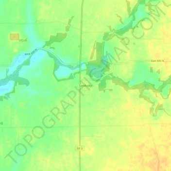
名称:Sandusky地形图、海拔、地势。
地点:Sandusky, Decatur County, Indiana, United States (39.39949 -85.49803 39.43949 -85.45803)
平均海拔:288 米
最低海拔:271 米
最高海拔:299 米
其他地形图
点击地图以查看其地形、其海拔和其地势。

点击地图以显示海拔。
名称:Sandusky地形图、海拔、地势。
地点:Sandusky, Decatur County, Indiana, United States (39.39949 -85.49803 39.43949 -85.45803)
平均海拔:288 米
最低海拔:271 米
最高海拔:299 米
点击地图以查看其地形、其海拔和其地势。