Tarbert地形图
点击地图以显示海拔。
关于这张地图
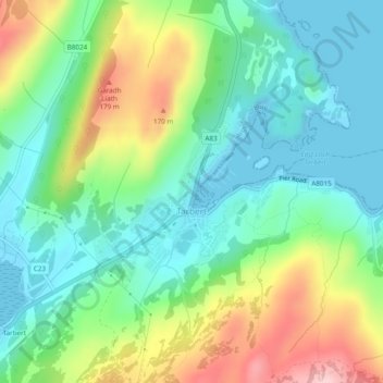
名称:Tarbert地形图、海拔、地势。
地点:Tarbert, Argyll and Bute, Scotland, United Kingdom (55.85852 -5.42750 55.87128 -5.38773)
平均海拔:69 米
最低海拔:0 米
最高海拔:213 米
其他地形图
点击地图以查看其地形、其海拔和其地势。

点击地图以显示海拔。
名称:Tarbert地形图、海拔、地势。
地点:Tarbert, Argyll and Bute, Scotland, United Kingdom (55.85852 -5.42750 55.87128 -5.38773)
平均海拔:69 米
最低海拔:0 米
最高海拔:213 米
点击地图以查看其地形、其海拔和其地势。