
Astoria地形图
点击地图以显示海拔。
关于这张地图
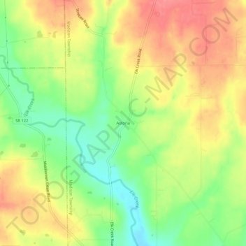
名称:Astoria地形图、海拔、地势。
平均海拔:263 米
最低海拔:221 米
最高海拔:300 米
其他地形图
点击地图以查看其地形、其海拔和其地势。
Oxford Township
United States > Ohio > Butler County
The highest point in Butler County, altitude 1,051 feet (320 m), is in Oxford Township.
平均海拔:289 米
Fairfield Township
United States > Ohio > Butler County
Fairfield Township's name is reflective of the gentle topography in the township. It is one of seven Fairfield Townships statewide.
平均海拔:207 米