点击地图以显示海拔。
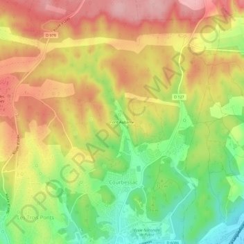
名称:Font Aubarne地形图、海拔、地势。
地点:Font Aubarne, Nîmes, Gard, Occitanie, France métropolitaine, 30034, France (43.85905 4.38390 43.89905 4.42390)
平均海拔:135 米
最低海拔:49 米
最高海拔:210 米
点击地图以查看其地形、其海拔和其地势。
France > Occitanie > Gard > Nîmes
平均海拔:78 米
平均海拔:60 米
平均海拔:116 米