
Tombstone地形图
点击地图以显示海拔。
Tombstone
The Tombstone District located at 31°42′57″N 110°3′53″W / 31.71583°N 110.06472°W / 31.71583; -110.06472 (31.715940, −110.064827) sits atop a mesa (elevation 4,539 feet ) in the San Pedro River valley between the Huachuca Mountains and Whetstone Mountains to the west, and the Mules and the Dragoon Mountains to the east. According to the United States Census Bureau, the city has a total area of 4.3 square miles (11.2 km2), all land.
关于这张地图
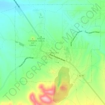
名称:Tombstone地形图、海拔、地势。
地点:Tombstone, Cochise County, Arizona, 85638, United States (31.69423 -110.08520 31.73423 -110.04520)
平均海拔:1,373 米
最低海拔:1,303 米
最高海拔:1,517 米