点击地图以显示海拔。
名称:Iruka地形图、海拔、地势。
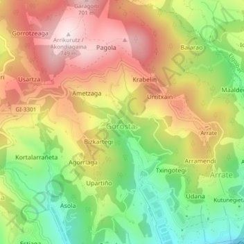
地点:Iruka, Maaspe, Gorosta, Eibar, Debabarrena, Gipuzkoa, Autonomous Community of the Basque Country, 20600, Spain (43.19582 -2.46914 43.21582 -2.44914)
平均海拔:425 米
最低海拔:105 米
最高海拔:740 米