
Ankeny地形图
点击地图以显示海拔。
Ankeny
Like most of Polk County, Ankeny exists at the bottom area of the Des Moines Lobe, a topographical landscape area, in an area known as the Bemis Advance. The Lobe was formed during the Wisconsin glaciation leaving significant deposits resulting in an area with low relief.
关于这张地图
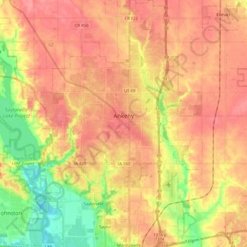
名称:Ankeny地形图、海拔、地势。
地点:Ankeny, Polk County, Iowa, United States (41.65213 -93.67277 41.80218 -93.54144)
平均海拔:284 米
最低海拔:237 米
最高海拔:314 米