
Kampung Gesir Tengah地形图
点击地图以显示海拔。
关于这张地图
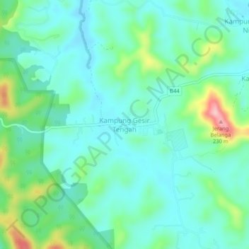
名称:Kampung Gesir Tengah地形图、海拔、地势。
地点:Kampung Gesir Tengah, Hulu Selangor, Selangor, 44020, Malaysia (3.70335 101.40431 3.74335 101.44431)
平均海拔:65 米
最低海拔:20 米
最高海拔:209 米
其他地形图
点击地图以查看其地形、其海拔和其地势。
Selayang Municipal Council
Given its varied topography pattern and close proximity to the Titiwangsa Mountains (Banjaran Titiwangsa), Selayang is a mix of urban and countryside sceneries. Its premier natural attraction, which is well known across the country, is the Forest Research Institute Malaysia (FRIM), also known as FRIM Kepong.…
平均海拔:236 米
Sungai Pajam
Malaysia > Selangor > Selayang Municipal Council > Rawang > Kampung Sungai Samak
平均海拔:86 米