Runyantown地形图
点击地图以显示海拔。
关于这张地图
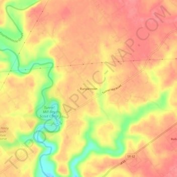
名称:Runyantown地形图、海拔、地势。
地点:Runyantown, Clark County, Indiana, United States (38.46951 -85.63468 38.50951 -85.59468)
平均海拔:183 米
最低海拔:134 米
最高海拔:205 米
其他地形图
点击地图以查看其地形、其海拔和其地势。

点击地图以显示海拔。
名称:Runyantown地形图、海拔、地势。
地点:Runyantown, Clark County, Indiana, United States (38.46951 -85.63468 38.50951 -85.59468)
平均海拔:183 米
最低海拔:134 米
最高海拔:205 米
点击地图以查看其地形、其海拔和其地势。