
Trexlertown地形图
点击地图以显示海拔。
Trexlertown
Trexlertown is located southwest of the center of Lehigh County along the southeastern edge of Upper Macungie Township at an altitude of 397 feet (121 m). It is bordered to the southwest by Breinigsville and to the southeast by Lower Macungie Township. U.S. Route 222 forms the northern edge of the community; US 222 leads northeast 3 miles (5 km) to its terminus at Interstate 78 outside of Allentown and southwest 30 miles (48 km) to Reading. Pennsylvania Route 100 forms the western edge of Trexlertown, leading north 11 miles (18 km) to its terminus at PA 309 near Pleasant Corners and south 27 miles (43 km) to Pottstown.
关于这张地图
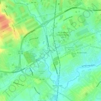
名称:Trexlertown地形图、海拔、地势。
平均海拔:127 米
最低海拔:110 米
最高海拔:159 米