
Sherwan地形图
点击地图以显示海拔。
关于这张地图
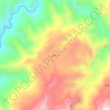
名称:Sherwan地形图、海拔、地势。
平均海拔:1,026 米
最低海拔:613 米
最高海拔:1,445 米
其他地形图
点击地图以查看其地形、其海拔和其地势。
Lora Tehsil
Pakistan > Khyber Pakhtunkhwa > Abbottābād District
Lora is located at an altitude of 1148 metres (3769 feet). It is situated in the southern part of Abbottabad District formerly part of Havelian Tehsil, it is now the headquarters of Lora Tehsil. It is bounded by the following union councils, Nara to the north, Nagri Totial to the north and east, Goreeni to the…
平均海拔:1,359 米