
Grissom Air Reserve Base地形图
点击地图以显示海拔。
Grissom Air Reserve Base
Upon receiving the Letter of Intent on 28 March 1942, Russell B. Moore Company established a temporary headquarters and moved personnel and necessary drafting, surveying and office equipment and supplies to an old schoolhouse at Bunker Hill, which they occupied until completion of the Construction Engineering Office on the site 13 May 1942. Surveying the site started 1 April 1942. J.L. Simmons Company, Inc. and United Construction Company received their Letter of Intent 4 April 1942, and immediately began moving equipment in to clear the site, including removal of buildings, trees, and grading as soon as elevations for the finished grade had been determined. Temporary structures were built, including a cement warehouse, a large general warehouse, 200 ft × 75 ft (61 m × 23 m), time office, a large number of movable, built on skids for easy removal, tool storage sheds and small storehouses. All construction material was delivered by truck until the completion of the spur track on 10 June 1942, after which a large portion of the construction material came in by rail. Peak days of traffic volume were as follows: 129 freight carloads of paving material received via the spur track on 30 October 1942, and 1755 truck loads of paving material received on 25 October 1942.
关于这张地图
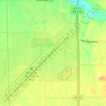
名称:Grissom Air Reserve Base地形图、海拔、地势。
平均海拔:244 米
最低海拔:225 米
最高海拔:258 米
其他地形图
点击地图以查看其地形、其海拔和其地势。