
Sulur地形图
点击地图以显示海拔。
Sulur
Sulur is located at 11°01′31″N 77°07′29″E / 11.0254°N 77.1246°E / 11.0254; 77.1246. It has an average elevation of 340 metres (1115 feet). Sulur is regarded as a pleasant town situated very close to the cities of Coimbatore "Manchester of South India" (19 km) and Tirupur (35 km). Thus it is a popular location for various textile mills and weaving slots. Near to Sulur there is a railway station and an Air Force base. The twin lakes to the north of the town, bounding the Coimbatore-Nagapattinam highway adds a scenic view to the town. The town is divided into two parts by the holy Noyyal River. Sulur is the East-end of the new Coimbatore district.
关于这张地图
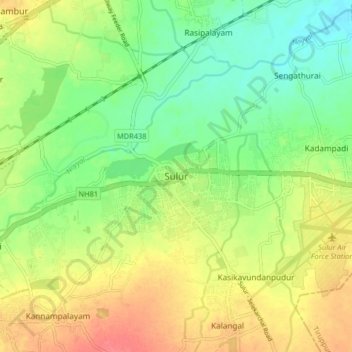
名称:Sulur地形图、海拔、地势。
地点:Sulur, Coimbatore, Tamil Nadu, 641402, India (10.98689 77.08586 11.06689 77.16586)
平均海拔:371 米
最低海拔:343 米
最高海拔:405 米
其他地形图
点击地图以查看其地形、其海拔和其地势。