点击地图以显示海拔。
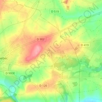
名称:Le Melleret地形图、海拔、地势。
地点:Le Melleret, Bricquebec, Bricquebec-en-Cotentin, Cherbourg, Manche, Normandie, France métropolitaine, 50260, France (49.45447 -1.62102 49.49447 -1.58102)
平均海拔:57 米
最低海拔:10 米
最高海拔:107 米