
Great Chart地形图
点击地图以显示海拔。
关于这张地图
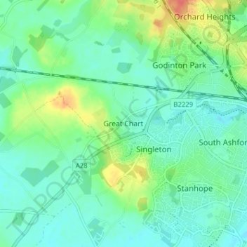
名称:Great Chart地形图、海拔、地势。
地点:Great Chart, Ashford, Kent, England, TN23 3AP, United Kingdom (51.12341 0.81217 51.16341 0.85217)
平均海拔:49 米
最低海拔:34 米
最高海拔:87 米
其他地形图
点击地图以查看其地形、其海拔和其地势。
Ham Street Woods National Nature Reserve
United Kingdom > England > Kent > Ashford > Hamstreet
平均海拔:31 米