
Chembe地形图
点击地图以显示海拔。
关于这张地图
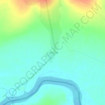
名称:Chembe地形图、海拔、地势。
地点:Chembe, Chembe District, Luapula Province, Zambia (-11.98651 28.72607 -11.94651 28.76607)
平均海拔:1,064 米
最低海拔:1,050 米
最高海拔:1,094 米
其他地形图
点击地图以查看其地形、其海拔和其地势。
Lake Bangweulu
Bangweulu — 'where the water sky meets the sky' — is one of the world's great wetland systems, comprising Lake Bangweulu, the Bangweulu Swamps and the Bangweulu Flats or floodplain. Situated in the upper Congo River basin in Zambia, the Bangweulu system covers an almost completely flat area roughly the…
平均海拔:1,172 米