
Traverse Bay地形图
点击地图以显示海拔。
关于这张地图
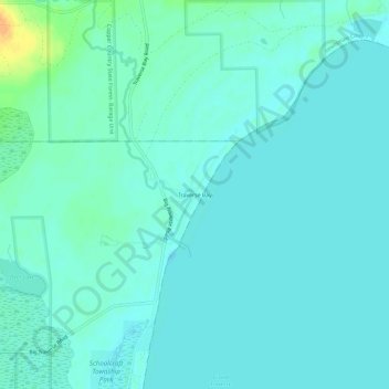
名称:Traverse Bay地形图、海拔、地势。
平均海拔:182 米
最低海拔:176 米
最高海拔:210 米
其他地形图
点击地图以查看其地形、其海拔和其地势。
Calumet
United States > Michigan > Houghton County
Calumet is at an elevation of 1,209 feet (369 m) above sea level. The village of Calumet sits on 2,000 miles (3,200 km) of underground mine shafts, drifts and stopes, empty for many decades. Large portions of the Keweenaw National Historical Park are located inside the village limits, mostly covering the…
平均海拔:369 米