
Manila地形图
点击地图以显示海拔。
Manila
Almost all of Manila sits on top of centuries of prehistoric alluvial deposits built by the waters of the Pasig River and on some land reclaimed from Manila Bay. Manila's land has been altered substantially by human intervention, with considerable land reclamation along the waterfronts since the American colonial times. Some of the city's natural variations in topography have been evened out. As of 2013, Manila had a total area of 42.88 square kilometers.
关于这张地图
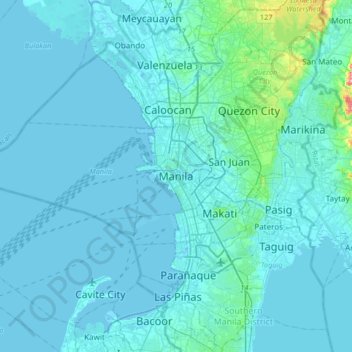
名称:Manila地形图、海拔、地势。
平均海拔:13 米
最低海拔:-3 米
最高海拔:230 米
其他地形图
点击地图以查看其地形、其海拔和其地势。