Bethel地形图
点击地图以显示海拔。
关于这张地图
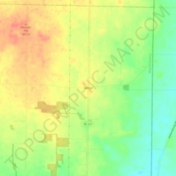
名称:Bethel地形图、海拔、地势。
地点:Bethel, Wayne County, Indiana, 45332, United States (39.96671 -84.85024 40.00671 -84.81024)
平均海拔:363 米
最低海拔:336 米
最高海拔:385 米
其他地形图
点击地图以查看其地形、其海拔和其地势。

点击地图以显示海拔。
名称:Bethel地形图、海拔、地势。
地点:Bethel, Wayne County, Indiana, 45332, United States (39.96671 -84.85024 40.00671 -84.81024)
平均海拔:363 米
最低海拔:336 米
最高海拔:385 米
点击地图以查看其地形、其海拔和其地势。