
Blake Hill地形图
点击地图以显示海拔。
关于这张地图
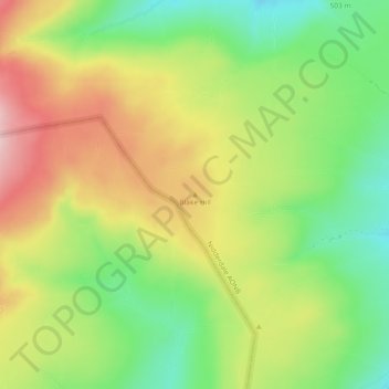
名称:Blake Hill地形图、海拔、地势。
地点:Blake Hill, North Yorkshire, England, United Kingdom (54.15266 -1.96135 54.15276 -1.96125)
平均海拔:543 米
最低海拔:447 米
最高海拔:652 米
其他地形图
点击地图以查看其地形、其海拔和其地势。
Scarborough
United Kingdom > England > North Yorkshire
The climate is temperate with mild summers and cool, windy, winters. The hottest months of the year are July and August, with temperatures reaching an average high of 17 °C and falling to 11 °C at night. The average daytime temperatures in January are 4 °C, falling to 1 °C at night. The station's elevation…
平均海拔:50 米
Malham
United Kingdom > England > North Yorkshire
Malham has an Oceanic climate, but is generally colder and wetter than most settlements in Britain. It has a relatively low altitude of around 200 metres, but is partly surrounded by fells. This exposed position means the temperature range is limited, due to little pooling of cold air. Extremes of temperature…
平均海拔:362 米
River Derwent
United Kingdom > England > North Yorkshire
Rainfall and climate conditions vary slightly across the Derwent catchment area due to the topography. Annual rainfall ranges from averages of 600 millimetres (24 in) at Barmby Barrage to over 1,100 millimetres (43 in) at its source on the North York Moors.
平均海拔:66 米
Harrogate
United Kingdom > England > North Yorkshire
Harrogate is situated on the edge of the Yorkshire Dales, with the Vale of York to the east and the upland Yorkshire Dales to the west and north-west. It has a dry and mild climate, typical of places in the rain shadow of the Pennines. It is on the A59 from Skipton to York. At an altitude of between 100 and…
平均海拔:131 米
North York Moors National Park
United Kingdom > England > North Yorkshire
As part of the United Kingdom, the North York Moors area generally has warm summers and relatively mild winters. Weather conditions vary from day to day as well as from season to season. The latitude of the area means that it is influenced by predominantly westerly winds with depressions and their associated…
平均海拔:110 米
Farlington
United Kingdom > England > North Yorkshire
The village is at an elevation of 123 feet (37 m) above sea level at its highest point. The nearest settlements are Stillington 2 miles (3.2 km) to the west; Sheriff Hutton 2.3 miles (3.7 km) to the east-south-east; Brandsby-cum-Stearsby 2.6 miles (4.2 km) to the north and Sutton-on-the-Forest 2.71 miles (4.36…
平均海拔:40 米
Thornton-le-Street
United Kingdom > England > North Yorkshire
The village is located between the west bank of the Cod Beck and the A168 road between Thirsk and Northallerton. Within a radius of 2.5 miles (4 km) can be found the settlements of Thornton-le-Moor, Borrowby, Knayton, Upsall, South Kilvington, Newsham and South Otterington. The mean elevation in the village is…
平均海拔:50 米
Malton
United Kingdom > England > North Yorkshire
As with the rest of the British Isles and Yorkshire, Malton possesses a maritime climate with cool summers and mild winters. The nearest Met Office weather station for which records are available is High Mowthorpe, about 6 miles (10 km) east of the town centre. Due to its lower elevation, the town centre is…
平均海拔:28 米
Middleham
United Kingdom > England > North Yorkshire
The town lies between 400 and 500 feet (120 and 150 m) above ordnance datum. The valley of the River Ure below the town has an altitude of 325 feet (99 m) and the summit of the hill to the south-west of the town of 850 feet (260 m). The parish contains 2,155 acres (872 ha) of land, mostly permanent pasture…
平均海拔:157 米