Chestatee North地形图
点击地图以显示海拔。
关于这张地图
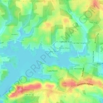
名称:Chestatee North地形图、海拔、地势。
地点:Chestatee North, Hall County, Georgia, 30506, United States (34.32593 -83.93935 34.36593 -83.89935)
平均海拔:353 米
最低海拔:322 米
最高海拔:411 米
其他地形图
点击地图以查看其地形、其海拔和其地势。

点击地图以显示海拔。
名称:Chestatee North地形图、海拔、地势。
地点:Chestatee North, Hall County, Georgia, 30506, United States (34.32593 -83.93935 34.36593 -83.89935)
平均海拔:353 米
最低海拔:322 米
最高海拔:411 米
点击地图以查看其地形、其海拔和其地势。