
Selising地形图
点击地图以显示海拔。
关于这张地图
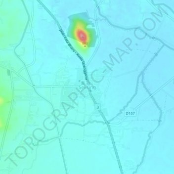
名称:Selising地形图、海拔、地势。
地点:Selising, Pasir Puteh, Kelantan, 16810, Malaysia (5.87492 102.31380 5.91492 102.35380)
平均海拔:12 米
最低海拔:2 米
最高海拔:110 米
其他地形图
点击地图以查看其地形、其海拔和其地势。
Kelantan River
The river's tributaries rise in the forested mountains in the Gua Musang region in southern Kelantan, where many Orang Asli tribes live. The area is known for its karst topography, dotted with mogotes with numerous caves beneath them. Some cave systems along the Nenggiri River, the river's left tributary, show…
平均海拔:71 米
Kuala Krai
Kuala Krai (alternative spelling: Kuala Kerai, Jawi: كوالا كراي) is a town located in the coterminous Kuala Krai District in southern-central Kelantan, Malaysia. During British protection it was known as Kuala Lebir. It is 67 km from state capital Kota Bharu and 273 km from national capital Kuala…
平均海拔:249 米