
Flash地形图
点击地图以显示海拔。
Flash
Flash is a village in the Staffordshire Moorlands and the Peak District National Park, England. At 1,519 feet (463 m) above sea level, it is the highest village in the United Kingdom (some sources claim a height of 1,531 feet (467 m) for Wanlockhead in Scotland, but a survey in 2019 showed that there are no buildings in Wanlockhead at that elevation). Flash was an early centre for Wesleyanism.
关于这张地图
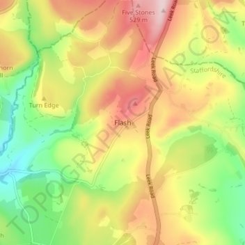
名称:Flash地形图、海拔、地势。
平均海拔:412 米
最低海拔:285 米
最高海拔:548 米
其他地形图
点击地图以查看其地形、其海拔和其地势。
Ladderedge Country Park
United Kingdom > England > Staffordshire > Staffordshire Moorlands > Leek
平均海拔:176 米
Rudyard Lake
United Kingdom > England > Staffordshire > Staffordshire Moorlands > Rudyard > Horton
平均海拔:205 米
Hales Hall Pool
United Kingdom > England > Staffordshire > Staffordshire Moorlands > Cheadle
平均海拔:182 米