
Stanhope地形图
点击地图以显示海拔。
关于这张地图
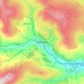
名称:Stanhope地形图、海拔、地势。
平均海拔:346 米
最低海拔:162 米
最高海拔:560 米
其他地形图
点击地图以查看其地形、其海拔和其地势。
Tunstall Reservoir
United Kingdom > England > County Durham > Wolsingham
The reservoir was created for the Weardale and Shildon District Waterworks Company, with construction of the dam between 1873 and 1879.[2][3] The earth embankment dam was built across the valley of Waskerley Beck, and measures 1,020 feet (310 m) long and 82 feet (25 m) high. It was constructed with a puddle…
平均海拔:288 米