
Ramsgill地形图
点击地图以显示海拔。
关于这张地图
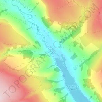
名称:Ramsgill地形图、海拔、地势。
平均海拔:260 米
最低海拔:133 米
最高海拔:437 米
其他地形图
点击地图以查看其地形、其海拔和其地势。
Harrogate
United Kingdom > England > North Yorkshire
Harrogate is situated on the edge of the Yorkshire Dales, with the Vale of York to the east and the upland Yorkshire Dales to the west and north-west. It has a dry and mild climate, typical of places in the rain shadow of the Pennines. It is on the A59 from Skipton to York. At an altitude of between 100 and…
平均海拔:131 米