
Freedom地形图
点击地图以显示海拔。
关于这张地图
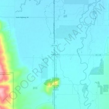
名称:Freedom地形图、海拔、地势。
地点:Freedom, Lincoln County, Wyoming, 83120, United States (42.96266 -111.06390 43.00266 -111.02390)
平均海拔:1,774 米
最低海拔:1,751 米
最高海拔:1,926 米
其他地形图
点击地图以查看其地形、其海拔和其地势。
Thayne
United States > Wyoming > Lincoln County
Thayne is located at 42°55′11″N 111°0′3″W / 42.91972°N 111.00083°W / 42.91972; -111.00083 (42.919754, –111.000714), at 5906 feet in elevation. It sits in the northern portion of Wyoming's grassy Star Valley, close to the Salt River. Thayne is surrounded by green grassland and ranches,…
平均海拔:1,814 米