
Dingboche地形图
点击地图以显示海拔。
Dingboche
Dingboche is a Sherpa village at an elevation of 4,410 m (14,470 ft) in the Khumbu region of northeastern Nepal. Its population was estimated at approximately 200 in 2011.
关于这张地图
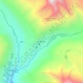
名称:Dingboche地形图、海拔、地势。
平均海拔:4,600 米
最低海拔:4,084 米
最高海拔:5,482 米
其他地形图
点击地图以查看其地形、其海拔和其地势。