Yellowhead County地形图
互动地图
点击地图以显示海拔。
关于这张地图
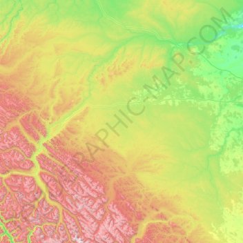
名称:Yellowhead County地形图、海拔、地势。
地点:Yellowhead County, 艾伯塔省, 加拿大 (52.65057 -118.89220 54.12164 -114.86881)
平均海拔:1,257 米
最低海拔:595 米
最高海拔:3,567 米

点击地图以显示海拔。
名称:Yellowhead County地形图、海拔、地势。
地点:Yellowhead County, 艾伯塔省, 加拿大 (52.65057 -118.89220 54.12164 -114.86881)
平均海拔:1,257 米
最低海拔:595 米
最高海拔:3,567 米