
Shale Mountain地形图
点击地图以显示海拔。
关于这张地图
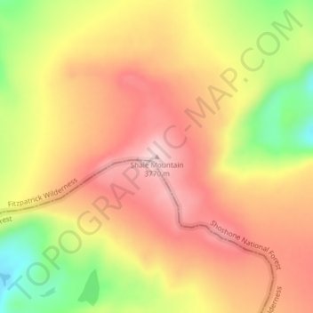
名称:Shale Mountain地形图、海拔、地势。
地点:Shale Mountain, Fremont County, Wyoming, United States (43.37462 -109.70771 43.37472 -109.70761)
平均海拔:3,664 米
最低海拔:3,503 米
最高海拔:3,772 米
其他地形图
点击地图以查看其地形、其海拔和其地势。
Dubois
United States > Wyoming > Fremont County
Dubois is located at 43°32′9″N 109°38′9″W / 43.53583°N 109.63583°W / 43.53583; -109.63583 (43.535936, -109.635915) and an elevation of 2115 m (6940 ft). The Wind River runs through the town.
平均海拔:2,167 米
Dubois
United States > Wyoming > Fremont County
Dubois is located at 43°32′9″N 109°38′9″W / 43.53583°N 109.63583°W / 43.53583; -109.63583 (43.535936, -109.635915) and an elevation of 2115 m (6940 ft). The Wind River runs through the town.
平均海拔:2,167 米