
Little Sturgeon地形图
点击地图以显示海拔。
关于这张地图
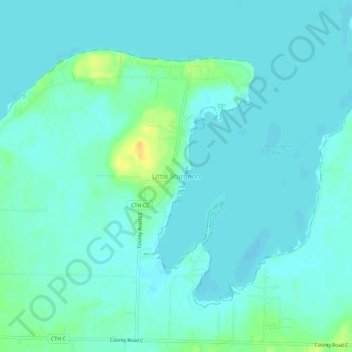
名称:Little Sturgeon地形图、海拔、地势。
平均海拔:179 米
最低海拔:173 米
最高海拔:201 米
其他地形图
点击地图以查看其地形、其海拔和其地势。
Sturgeon Bay
United States > Wisconsin > Door County
Stevens Hill is a populated place within the city of Sturgeon Bay, just to the northeast of the downtown. The top of the hill has the highest elevation in the city. It is within Big Hill Park, which is 13.2 acres in area and is used for mountain biking, picnicking, and sledding.
平均海拔:199 米