Derryfubble地形图
点击地图以显示海拔。
关于这张地图
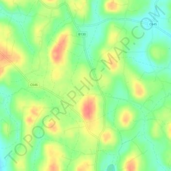
名称:Derryfubble地形图、海拔、地势。
地点:Derryfubble, Armagh, Northern Ireland, United Kingdom (54.43565 -6.76717 54.44723 -6.75339)
平均海拔:63 米
最低海拔:37 米
最高海拔:94 米

点击地图以显示海拔。
名称:Derryfubble地形图、海拔、地势。
地点:Derryfubble, Armagh, Northern Ireland, United Kingdom (54.43565 -6.76717 54.44723 -6.75339)
平均海拔:63 米
最低海拔:37 米
最高海拔:94 米