
Smithers地形图
点击地图以显示海拔。
关于这张地图
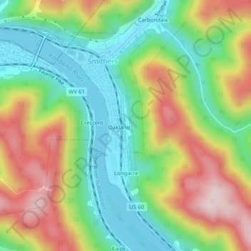
名称:Smithers地形图、海拔、地势。
地点:Smithers, Fayette County, West Virginia, United States (38.15809 -81.31609 38.18856 -81.29589)
平均海拔:341 米
最低海拔:183 米
最高海拔:567 米
其他地形图
点击地图以查看其地形、其海拔和其地势。
Glen Jean
United States > West Virginia > Fayette County
The latitude of Glen Jean is 37.926 N. The longitude is 81.15 W. It is in the Eastern Time Zone. The elevation is 1,627 feet.
平均海拔:549 米