
Tysonville地形图
点击地图以显示海拔。
关于这张地图
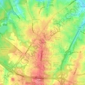
名称:Tysonville地形图、海拔、地势。
平均海拔:118 米
最低海拔:71 米
最高海拔:155 米
其他地形图
点击地图以查看其地形、其海拔和其地势。
William B. Umstead State Park
United States > North Carolina > Wake County > Raleigh
Umstead is part of the Southeastern mixed forests ecoregion. The topography is hilly, and it has several artificial lakes (which are very common in Wake County, partially due to a flood control plan implemented over the last half-century).
平均海拔:116 米