
Toolangi地形图
点击地图以显示海拔。
关于这张地图
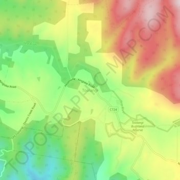
名称:Toolangi地形图、海拔、地势。
地点:Toolangi, Shire of Murrindindi, Victoria, Australia (-37.55338 145.44725 -37.51338 145.48725)
平均海拔:460 米
最低海拔:250 米
最高海拔:690 米
其他地形图
点击地图以查看其地形、其海拔和其地势。
King Valley
The King Valley has a history that includes bushrangers, Chinese and Italian immigration. Chinese migrants came from the Victorian Goldfields in the mid-19th century and began careers as market gardeners, tobacco growers and merchants. Many roads in the Valley today carry the names of such families, like…
平均海拔:295 米
Collingwood
Australia > Victoria > Melbourne
Collingwood's topography is mostly flat, but a prominent slope extends from Hoddle Street up to Smith Street, and also along sections of Hoddle Street.
平均海拔:30 米