
Annapurna I地形图
点击地图以显示海拔。
Annapurna I
The mountain is named after Annapurna, the Hindu goddess of food and nourishment, who is said to reside there. The name Annapurna is derived from the Sanskrit-language words purna ("filled") and anna ("food"), and can be translated as "everlasting food". Many streams descending from the slopes of the Annapurna Massif provide water for the agricultural fields and pastures located at lower elevations.
关于这张地图
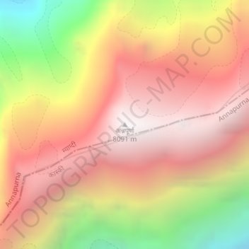
名称:Annapurna I地形图、海拔、地势。
地点:Annapurna I, Annapurna, Myagdi, Gandaki Province, Nepal (28.59576 83.81987 28.59586 83.81997)
平均海拔:7,126 米
最低海拔:5,740 米
最高海拔:8,033 米
其他地形图
点击地图以查看其地形、其海拔和其地势。