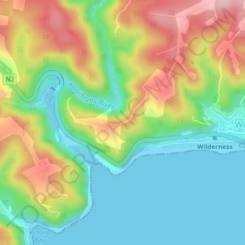
地理定位

Map of Africa地形图

点击地图以显示海拔

关于这张地图

名称Map of Africa地形图、海拔、地势。

地点Map of Africa, Remskoen, George Local Municipality, George, Western Cape, 6560, South Africa (-33.99308 22.56076 -33.99298 22.56086)

平均海拔:80 米

最低海拔:-2 米

最高海拔:208 米

其他地形图

点击地图以查看其地形、其海拔和其地势

Garden Route Dam

South Africa > Western Cape > George

平均海拔:200 米

Oudtshoorn

South Africa > Western Cape > George

平均海拔:353 米

Touwsranten

South Africa > Western Cape > George

平均海拔:202 米

Friemersheim

South Africa > Western Cape > George

平均海拔:262 米

Oudtshoorn

South Africa > Western Cape > George

平均海拔:353 米

Oudtshoorn

South Africa > Western Cape > George

平均海拔:353 米

Danabaai

South Africa > Western Cape > George

平均海拔:109 米