Cofer地形图
点击地图以显示海拔。
关于这张地图
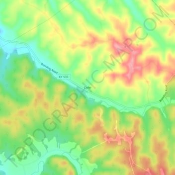
名称:Cofer地形图、海拔、地势。
地点:Cofer, Metcalfe County, Kentucky, United States (36.93978 -85.51024 36.97978 -85.47024)
平均海拔:273 米
最低海拔:220 米
最高海拔:328 米
其他地形图
点击地图以查看其地形、其海拔和其地势。

点击地图以显示海拔。
名称:Cofer地形图、海拔、地势。
地点:Cofer, Metcalfe County, Kentucky, United States (36.93978 -85.51024 36.97978 -85.47024)
平均海拔:273 米
最低海拔:220 米
最高海拔:328 米
点击地图以查看其地形、其海拔和其地势。